
- Key Takeaways
- Using the WMATA Trip Planner
- Beyond Basic Directions
- Planning for Accessibility
- Navigating Service Changes
- Mastering Your Commute
- Your Data and Privacy
- Conclusion
- Frequently Asked Questions
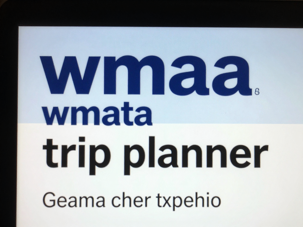
- What is the WMATA Trip Planner?
- How do I use the WMATA Trip Planner?
- Does the WMATA Trip Planner offer accessible route options?
- Can the WMATA Trip Planner show real-time service updates?
- Is the WMATA Trip Planner free to use?
- Will my personal data be safe when using WMATA Trip Planner?
- Can I plan trips for future dates with WMATA Trip Planner?
Key Takeaways
- The WMATA Trip Planner provides integrated bus, metro, and walking directions for point-to-point travel in the DC area.
- Real-time tracking and proactive travel alerts keep users informed of delays, service changes, and next departure times so they can more easily adapt plans.
- Users can save favorites and common origins inside the app, making future trip planning faster.
- There’s transparent fare info, payment options, and discount possibilities, letting travelers plan how much their trips will cost.
- Accessibility features and up-to-the-minute elevator availability provide inclusive travel for all users.
- With crowd monitoring and alternate routes, you can beat the rush, save time and travel in comfort.
About WMATA Trip Planner
WMATA Trip Planner is a Washington, DC-area public transit trip planning online tool from the Washington Metropolitan Area Transit Authority. The tool allows you to search for bus and rail routes, view schedules, and view travel times for destinations throughout the region. Riders can input origins, select destinations, and specify travel times to view optimal path options and fare information. The trip planner includes real-time service changes and provides turn-by-turn travel directions. WMATA Trip Planner operates in both desktop and mobile browsers, allowing users to plan trips while on the move. The following tips highlight how to use the tool and what features help make trip planning simple and fast.
Using the WMATA Trip Planner

WMATA Trip Planner will help you find the most convenient public transit routes around Washington DC and surrounding regions. It provides a comprehensive perspective on bus, metro, and walking routes, with real-time travel options, maps, and live tracking enabling users to easily plan trips wherever they begin.
1. Starting Point
Plan a route by entering your address, landmark, or by selecting a saved location from your account. The map tool displays all the nearby metro stations and bus stops so you can easily identify the closest. If you frequently travel from the same location, save it for next time. It’s a time saver and reduces typing. It doesn’t matter if you’re at home, the office, or exploring a new location. Simply pick your starting point.
2. Your Destination
Enter your destination by typing in the address, a landmark, or choosing from saved locations. The planner shows what’s surrounding your destination, like tourist stops or stores, so you can optimize your visit. Check the area on the map to make sure you’re headed to the right spot and see which bus or metro stops are nearby. With multiple route recommendations, you’re covered whether you want the fastest or easiest route.
3. Trip Options
The Trip Planner provides you with several route options, mixing bus, metro, and walking to suit your preferences. You can tell which options have fewer transfers or shorter transit time. If you prefer fewer transfers or want to reduce walking distance, specify those in the filters. It lists alternate routes, so if something does not work, you’ve got a backup.
| Option | Mode | Travel Time (min) | Transfers | Walking (m) |
|---|---|---|---|---|
| Route 1 | Metro | 25 | 0 | 300 |
| Route 2 | Bus+Metro | 30 | 1 | 200 |
| Route 3 | Bus | 40 | 2 | 100 |
4. Route Details
Trip Planner details every route, highlighting stops, bus or train changes and the duration of each segment. It flags service alerts, delays or planned work that could bog you down. The map tags all the key stops so you can view the entire route. You can even see when the next bus or train departs, so you can time your trip to minimize wait.
5. Real-Time Tracking
Real-time pin your bus or train as it travels, providing instant locations and arrival projections. If there’s a delay or last-minute change, you’ll receive a notification right in the planner. Next train boards and bus updates tell you when your ride is arriving so you can plan accordingly. Staying updated is easy, so you wait less and go more.
Beyond Basic Directions

WMATA Trip Planner is not just for point-to-point directions. It aids passengers in maximizing a sprawling metro and bus system that links DC with Virginia and Maryland. The system map, with its six color-coded lines—Red, Blue, Orange, Yellow, Green, Silver—makes navigation straightforward. There are frequent trains arriving for commuters and visitors alike, particularly during peak hours. Free Wi-Fi, cell service in tunnels and welcoming support from other riders enhance the experience. The planner takes it a step beyond basic directions, allowing users to view fare information, bookmark favorite locations and search for alternative travel options.
| Fare Type | Payment Method | Service Metrics | Travel Options |
|---|---|---|---|
| Standard Fare | SmarTrip card, mobile | Frequent trains | Metro, Bus, Regional Links |
| Reduced Fare | Contactless card, cash | Free Wi-Fi | Walking, Multi-modal travel |
| Discounts | Mobile wallet, vouchers | Reliable data | Accessible stations |
Multi-Modal Travel
Trip Planner assists riders in connecting metro and bus for seamless, expedient travel throughout all four DC quadrants and into adjacent suburbs. To these we add walking segments to connect with public transit stops, ensuring the routes are feasible in real-world scenarios. It provides information on transfers to other area networks, such as MARC or VRE for travel beyond WMATA’s primary coverage area. Users can compare routes across various combinations—bus, rail, or foot—helping them choose the quickest or most convenient. This is particularly handy if you’re new in town or need to switch things up during a lengthy journey.
Favorite Locations
The app lets riders save favorite locations, so they don’t have to key them in every time. These can be categorized, for example under “Work,” “Home,” or “Airport,” so planning ahead is fast and simple. Saved spots can be shared with others, helping families or groups plan together. Having fast access to these spots saves your planning time, and riders can access their editable list anytime.
Fare Information
Standard, reduced, and discount fares are offered, each with separate regulations. Regular rates are charged for the majority of adults, with price reductions available to seniors, individuals with disabilities, and select students.
Fares are paid with SmarTrip cards, contactless credit or debit cards, and mobile wallets. Cash is accepted at select machines.
Riders should look for fare updates or short-term deals that can impact trip prices.
Beyond simple directions, the planner displays fare ranges per route so you can select the most suitable option for your budget and requirements.

Planning for Accessibility
Accessibility is integrated within the WMATA trip planner to assist individuals with varying requirements in navigating more easily. It provides straightforward information to assist riders in locating routes, anticipating elevator usage and accessing support when necessary.
- Real-time elevator and escalator status updates
- Step-free station entries and exits
- Accessible train cars and low-floor or ramp-equipped buses.
- Easy-to-read schedules and maps
- Text-to-speech and screen reader support
- Priority seating and space for mobility aids
- Service alerts for accessibility-related changes
- Multi-language support for key accessibility info
Trip planner displays current elevator or escalator news for all stations. Riders can find out if a lift is operating in advance of leaving home, a feature that benefits anyone with a stroller or wheelchair. Station pages specify which entrances are step-free and the location of ramps or lifts. The planner notes stops and lines that are optimal for those with mobility issues, so users can select the best route. For instance, if a station lift is down, the planner can propose a new route or perhaps a nearby station with a working lift. This level of detail helps you avoid last-minute changes and long detours.
Some trip planning tools allow you to filter for easy-access routes. Riders specify their needs before beginning a search, so the planner displays only top options for step-free journeys or ramp-equipped buses. The tool indicates whether a particular line or stop has ramps, priority seats or room for wheelchairs. For instance, a cane user can choose the path with fewest stairs, or a stroller pusher can seek out low-floor buses.
Access Planning
Support is accessible for riders with access questions. It offers a quick connection to customer help, e-mail, and phone support for any problems or requirements. Riders can inquire about station layouts, receive trip planning tips, or report problems with lifts or ramps. For riders requiring assistance at a stop or station, personnel can provide direction and assistance as necessary.
Navigating Service Changes
Service changes are a way of daily transit life for many riders using the WMATA trip planner. These changes occur on weekends or weekdays, typically for construction, maintenance, or to modernize routes. Riders have to hear about these changes to keep their plans on schedule and avoid last-minute stress. When you’re unaware of a service change, it can result in delays, missed connections, or even extended journeys, so it’s worth taking a moment to check for updates before you head out.
The trip planner will alert you to service changes such as delays, new schedules or rerouted lines. For instance, when there’s construction on a metro line, the planner could display bus alternatives or recommend other rail options. This allows travelers to bypass shut down stations or delays. Real-time features, including train countdowns and service notifications that provide up-to-the-minute info, allow riders to know when their next train or bus is arriving. These are useful for anyone looking to make fast route changes or understand how long they need to wait, particularly when service is not operating normally.
When service changes are implemented to enhance service or to connect new areas, the planner updates to include new links or stops. That could translate into quicker rides or additional alternatives to traverse town. For example, if a new bus route links the city’s outer suburbs with inner neighborhoods, the planner will display optimal routes that incorporate the new connection. This encourages riders to try out new routes or reduce commute time.
Passengers experience delays or disruptions when these updates occur, and that can be hard. The best way to navigate service changes is by staying informed and getting ahead of the curve. It helps reduce the blow of abrupt service changes and lets your days keep flowing. Riders can provide feedback or participate in outreach events, sharing their experience with service changes impacting their trips.

To manage service changes:
- Consult the planner for alerts or new schedules prior to each trip.
- Try our live update tools for delays or next arrivals.
- Experiment with different paths or styles if your normal path is blocked.
- Share feedback with WMATA to help improve services
Mastering Your Commute
The WMATA Trip Planner helps smart commuters make smart commute decisions with features including real-time updates, route suggestions, and multimodal transit options. Mastering your commute is all about timing, travel, and making your daily journey the most productive and least stressful time of your day.
Avoiding Crowds
Watch the crowding data in the WMATA Trip Planner and pick a less busy time. Each time you check the app, it refreshes crowd levels for each train and bus, letting you reschedule to avoid the rush. Most commuters I know can shift their departure by just 15 minutes earlier or later than usual and skip the crowds. User feedback and live data indicate when platforms and vehicles are most crowded, putting more control over your travel in your hands.
When platforms are crowded, tension escalates and ease diminishes. Don’t be afraid to experiment with alternate routes or lines, even if they add minutes to your trip. Sometimes your longer route with fewer people is actually faster and nicer than waiting in jammed stations. Community-shared traffic patterns provide great advice on congested routes and secret shortcuts.
Exploring New Routes

Experimenting with new routes reduces both waiting and crowding. The trip planner recommends alternate routes according to live service announcements and new developments, such as a new bus network or merged routes. Keep tabs on new launches because re-imagined lines usually lead to less crowded and quicker rides.
Consider alternative forms of transit such as biking, walking, or leveraging a ride-hailing app to get where you need to go. Others employ mapping tools to monitor secure bike routes or walk small stretches between stops. Community input provides invaluable feedback on which new routes are performing best when schedules shift or service gaps emerge.
Saving Time
Master Your Commute – WMATA Trip Planner (WMATA)
This free app helps commuters find the fastest way to get to work by comparing travel modes and notifying users of delays. If you plan trips for the off-peak hours, you wait less and have easier rides. Real-time alerts allow you to switch plans on the fly if there is a delay or disruption, saving precious minutes.
It’s multi-modal in the city. Riders frequently combine biking, car-sharing, or even slugging, which is carpooling with strangers, to bridge distances between home, work, and transit stops. It’s crucial to know exact start and end points and commute distance. Utilizing a mix of transit options simplifies your ride and provides options for that pesky last mile.
Your Data and Privacy

WMATA Trip Planner processes various user data to aid in route planning, schedule tracking, and service enhancement. So what happens with your data and privacy? Let’s take a closer look at the app’s privacy policy. Here, it clarifies what information the app collects, like trip history, device type, or saved locations. It specifies whether information is shared with third-party partners or remains in-house. For instance, if you use the planner to save routes between cities, the policy should disclose if the app stores this info or if it’s purged after use. By reading these details, you are aware of what is happening with your data and what rights you have over it.
Privacy is in your hands with account settings. Most trip planners, including WMATA’s, provide methods to select what you share. Here you can opt to disable location tracking, prevent some alerts from coming through, or wipe saved searches. For instance, you may wish to receive notifications about route alterations but not share your location data with the application. These are frequently presented in bare menus so it is easy to tweak preferences as your predilections evolve. Tuning notifications and data sharing prevents the app from gathering more than necessary and helps keep your use of the planner in line with your comfort.
Feedback options in the application allow users to voice concerns over privacy. WMATA’s planner usually has a feedback form or support email for concerns or inquiries about your data usage. If you catch vague wording in the privacy policy or if you believe your data is being utilized in manners you didn’t consent to, you have the ability to contact. Users who provide feedback assist in influencing the privacy practices over time as app teams use this feedback to address vulnerabilities or clarify decisions more effectively. For example, if many users request stronger data wipes, the team could introduce a new tool to delete trip logs quicker.
Keeping up with privacy changes is crucial for all users. WMATA occasionally revises its privacy rules to keep up with new legislation or launch new services. Monitoring in-app notices or email alerts keeps users abreast of changes. For instance, if a new data collection tool launches, you will know how to immediately adjust your settings.
Conclusion
WMATA Trip Planner removes the mystery from getting from one point to another in the city. Riders can check times, search for step-free routes, and get ahead of line changes or delays. The tool provides live updates and transparent instructions, so regular riders and novices alike are in the loop. Something for everyone! Commuters and riders with different needs can find routes and stops that work for them. The planner prioritizes privacy and does not track trips. To optimize your ride, use the planner on your next trip. Explore all the new features, discover what’s best for you, and share feedback so everyone can plan with ease.
Frequently Asked Questions
What is the WMATA Trip Planner?
The WMATA Trip Planner is an online tool that helps you plan routes using public transportation in the Washington, D.C. Area. It provides step-by-step directions, schedules, and fare information.
How do I use the WMATA Trip Planner?
Type in your origin and destination. The planner will display transit choices, durations, and transfer information. Feel free to tweak your preferences for the fastest route, fewer transfers, or accessible stations.
Does the WMATA Trip Planner offer accessible route options?
Yes, the WMATA Trip Planner has accessible route options. Choose preferences for step-free paths, elevators and accessible vehicles.
Can the WMATA Trip Planner show real-time service updates?
Yes, the planner includes real-time delay, service change, and schedule information. This way, you can steer clear of any impromptu chaos along the way.
Is the WMATA Trip Planner free to use?
Yes, it’s free with the WMATA Trip Planner. No account or fee is required to plan your trip.
Will my personal data be safe when using WMATA Trip Planner?
WMATA respects your privacy. Trip Planner does not retain personal travel history or sensitive information. Be sure to check out their privacy policy.
Can I plan trips for future dates with WMATA Trip Planner?
Indeed, you can select the date and time of your trip. The planner will give you the best transit options for your schedule.